Operations teams pay close attention to rail sightings to get a sense of how the journey is progressing. When things are going well, these sightings will put everyone at ease. They also provide valuable clues when things are going wrong.
A veteran operator can mentally compute an accurate ETA from a rail sighting on a carrier website if they know from experience where that location actually is.
But that’s the challenge for any tracking system: These sightings are often reported by the railroads as cryptic facility codes that can’t be easily resolved to locations on a map.
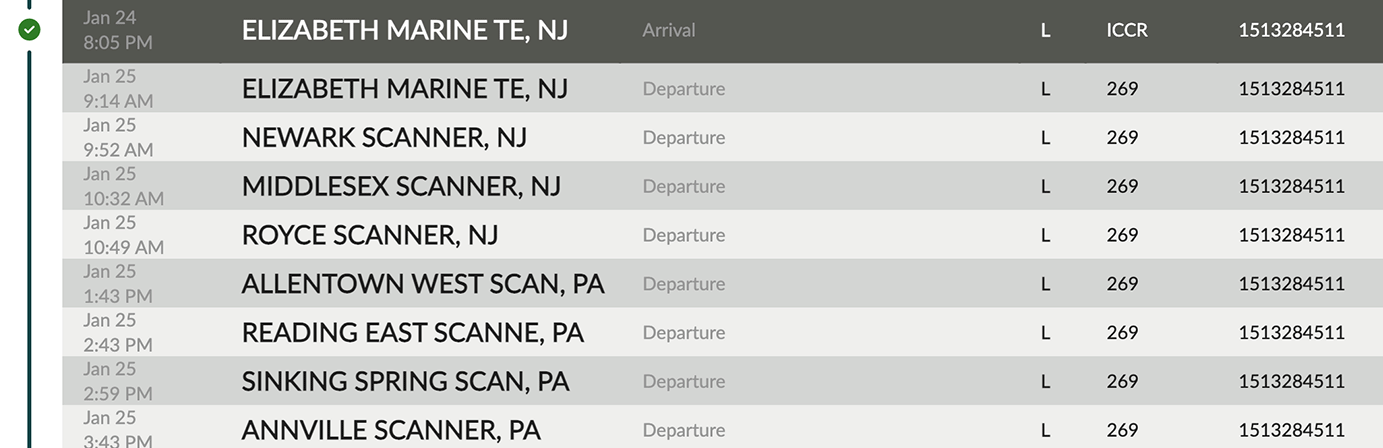
They might look something like this:

They may refer to a nickname, an internal codename, or even the name of an old ghost town that used to have a rail station. Google Maps has no idea what to do with these.
Why this matters
We use rail sightings not only to report location updates on the route, but also to calculate predictive ETAs for rail legs. If a sighting can't be resolved to a real location, it's invisible to the ETA model. The container is moving, but the system doesn't know where, and neither does your team.
For an operations desk managing hundreds of containers on rail at any given time, that gap becomes noise. The sightings are there, but they aren't actionable. Your team ends up spending hours Googling facility codes, cross-referencing carrier maps, or just waiting for the next sighting and hoping it's one they recognize.
How we solved it
Our team spent months manually mapping thousands of these locations, cross-referencing facility codes against railroad archives, carrier documents, and location databases until the correct coordinates were pinned down. That painstaking, manual process is now handled by an AI agent trained on the patterns and sources he discovered along the way.
The sources are as varied as the codes themselves: railroad archives, LoadMatch facility databases, and, believe it or not, MapQuest, which turns out to be surprisingly good at resolving obscure rail junctions that Google Maps has never heard of.
We spent thousands of hours resolving these locations so your ops team doesn't have to. Every time a sighting comes through as "CP-509, IL" and your dashboard shows it as a precise point on a map with an updated ETA, that's the result.

What this means for your team
When sightings resolve to real locations, everything downstream improves. ETAs become more dependable. Exception triage is faster because you can see exactly where a container is sitting, not just that it was scanned at some unrecognizable code. Your ops team spends less time translating cryptic codes and more time making decisions.
We spent thousands of hours building this location intelligence so your team doesn't have to. Every time a sighting comes through as "CP-509, IL" and your dashboard shows it as a precise point on a map with an updated ETA, that's the result.
If your team is still squinting at rail codes and guessing where containers are, get in touch. We've already done the homework.

_500.png)